
The utility of space-based imagery was obvious almost from the moment that people thought of putting cameras in space, but for the first decade or so of spaceflight, the ability to launch things was limited to only the USSR and the US, and they used this capability primarily for military purposes, with limited exceptions for communications and meteorology.
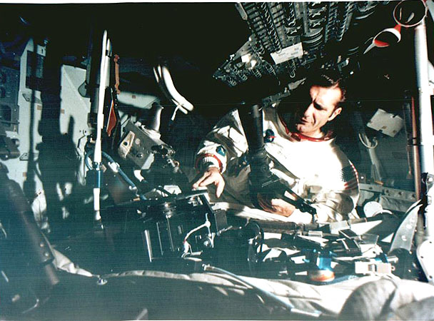
Dick Gordon sets up a Hasselblad camera in the Apollo 12 simulator
Because of the cloak of secrecy that shrouded both side's reconnaissance satellite programs, the first good look anyone in the wider world got at the Earth from space was through cameras carried aboard manned spacecraft. At least on the US side, these were Hasselblad handheld cameras, and produced stunning photos that had nowhere near the resolution of something like Corona. But they were still of great interest to researchers in fields like agriculture, forestry, hydrology and geology, who had a new window onto the planet that they studied. Pressure began to build for a dedicated platform to produce low-resolution imagery for Earth scientists, finally culminating with the flight of Earth Resources Technology Satellite-1, later known as Landsat-1, in 1972.
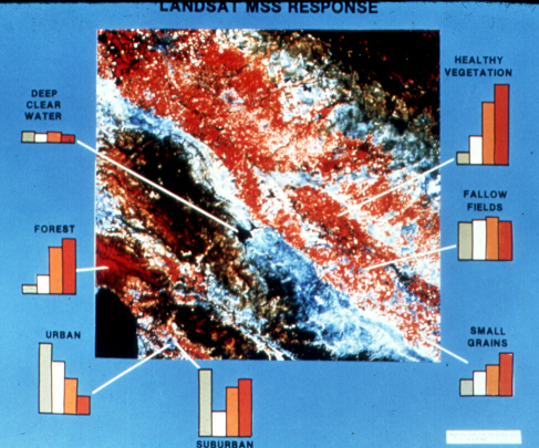
Landsat-1 carried an instrument known as the Multi-Spectral Scanner (MSS) that produced separate images in four different spectral bands (two IR, green and red). Combinations of these could produce astonishing amounts of information about the world below, thanks to the differing response of various terrains in different bands. This, combined with the fact that the satellite would continue to return data for several years instead of days or weeks, also meant it was useful for tracking changes in the environment, be it the slow spread of a city or the extent of damage from a dam breaking. The MSS's resolution was only about 80 m, useless for direct military purposes but more than enough for scientists, and the data could be widely disseminated, including to other countries. Almost as important, it was among the first systems that transmitted data electronically instead of returning film, predating the KH-11 by almost 5 years. This allowed the first satellite to remain in service for half a decade, with subsequent satellites lasting even longer.
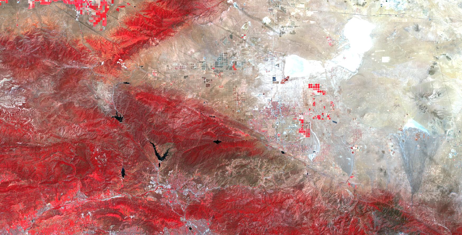
A Landsat composite of the area around Edwards AFB, May 2025. Red represents growing plants.1
Landsat 1 was enough of a success that it was followed by two more repeats over the next decade, before the first second-generation satellite, Landsat 4, was flown. It carried not only the MSS but also an improved Thematic Mapper with 7 bands, giving scientists more options, as well as an improvement in resolution to 30 m and the ability to measure surface temperatures directly. Landsat remains so useful that the program continues to this day, with Landsat 8 launched in 2013 and Landsat 9 in 2021, both carrying the Operational Land Imager, which adds two more bands, but otherwise maintains the 30 m resolution to make data comparisons across time easier. All Landsat data is freely available to the public, in case anyone is interested in seeing what their city looks like in near-IR.2
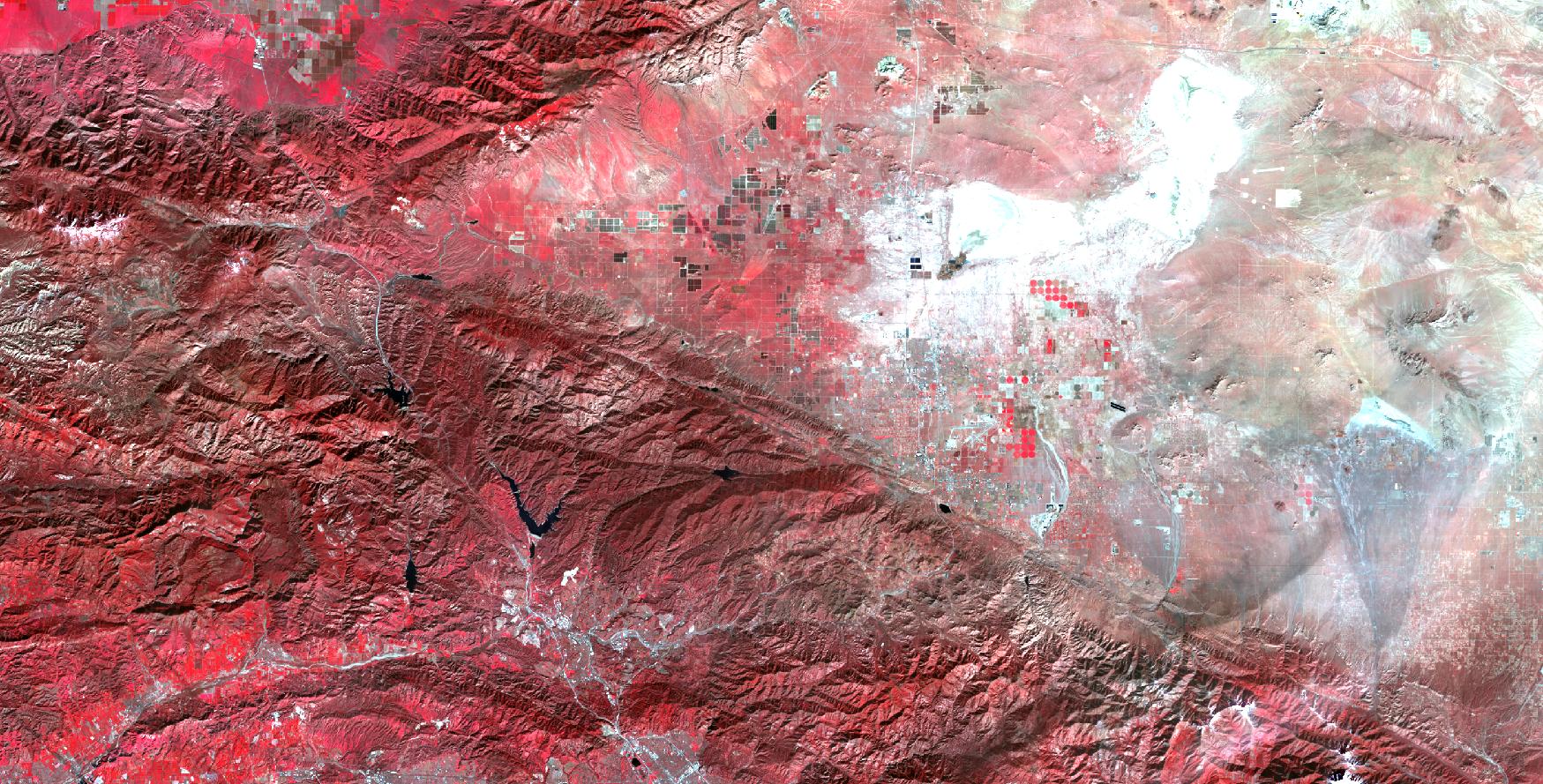
The same area in January 2024. Note the growing plants in the top of the image where there are none in June.3
The utility of Landsat unleashed a flood of efforts to gather Earth-resources data of all sorts. More and more advanced radiometer/imager systems were flown on a variety of satellites, to provide either more bands of data,4 higher-resolution data, or more frequent coverage, which has applications in areas like disaster monitoring. Radiometry also moved into the microwave bands, which was most useful for measuring atmospheric characteristics like temperature and water vapor content. Active use of radio waves also began, ranging from simple altimeters to measure the broad shape of the planet to more-sophisticated synthetic aperture radar capable of producing detailed terrain maps5 or studying the structure of ocean waves. Active lidar is often used, primarily to study the structure of the atmosphere. Then there's really exotic methods, like flying a pair of satellites to map the exact shape of the Earth's gravity field and studying how GPS signals are reflected by the Earth or bent by the atmosphere.
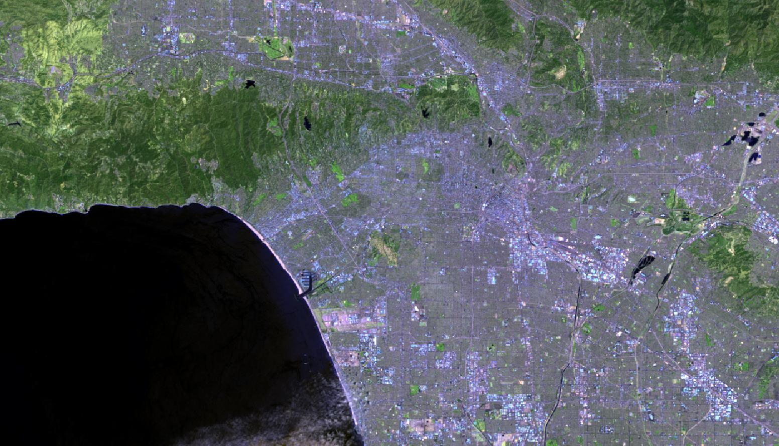
Downtown LA and areas to the west, June 20246
Of course, all of this is very abstract unless you are an Earth-resources scientist or an extreme nerd, and many other people have benefited from the explosion in satellite data over the last few decades. China was the third power to get into the recon satellite game, beginning with the Fanhui Shi Weixing series in 1975. This was a film-based system broadly equivalent to Corona or Zenit, and one was launched every year or so through the rest of the Cold War. Their program was fairly quiet through the 90s, but starting with ZY-2 in 2000, they have conducted an extensive recon satellite campaign, largely under the Yaogan banner. Their program includes all of the usual suspects, optical, SAR and ELINT, although it's perhaps most notable for their attempt at building an optical ship-tracking constellation that should be able to provide worldwide real-time imagery with enough resolution to make the sea much smaller. It's not clear how well this will work in practice.
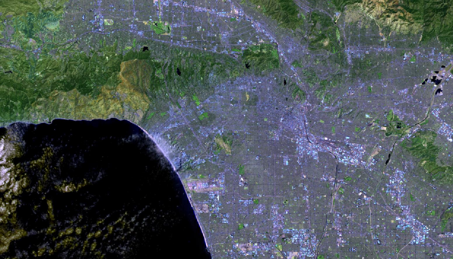
The same area in May 2025, showing the scars of wildfires
But the big change for non-nerds in recent years has been the commercial availability of high-resolution imagery. This began with the French SPOT series in the mid-80s, which produced 10 meter images for both commercial and military customers.7 In the mid-90s, the Russians, strapped for cash, began to sell meter-scale imagery taken using their film-return satellites. But it was the introduction of IKONOS in 2000 that really set off the satellite imaging boom. Offering .8 m panchromatic or 4 m color imaging,8 the satellite gave anyone with some cash a capability not too far off what the NRO spent billions on. Since then, there has been an explosion of such services, including GeoEye/DigitalGlobe, which provide much of the imagery for Google Maps, and PlanetLabs, which focuses on providing daily imagery of the entire Earth's surface with its Dove and SkySat constellations of small satellites. This real-time data is immensely valuable for everything from natural resources management to disaster response to analyzing how a store is doing by looking at its parking lot, even if the resolution isn't cutting-edge.9 There have even been commercial SAR satellites like TerraSAR-X, with applications ranging from creating basic elevation models to tracking changes in the Earth's surface to tracking ships at sea.
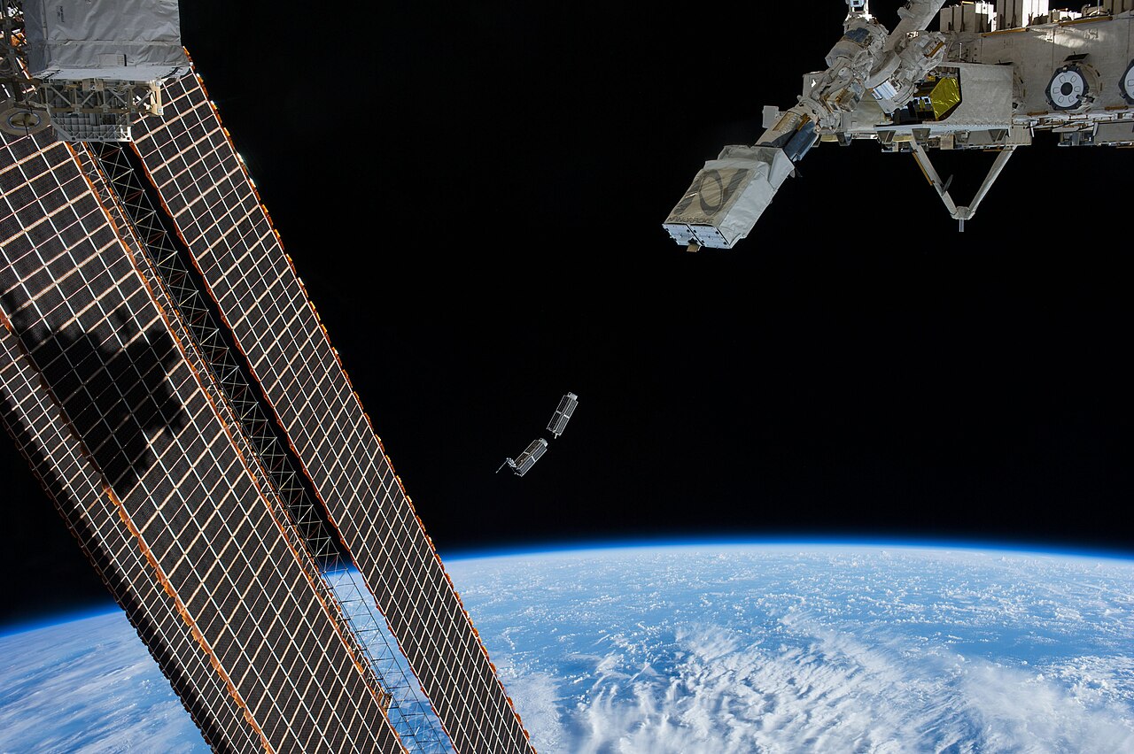
Two Planet Labs Dove satellites are launched from the ISS
The military implications of this capability are obvious, and much like the situation with commercial comsats, governments from the United States on down are major users of commercial satellite imagery. Despite this, a growing number of countries have flown their own imaging satellites, including Japan, India, Israel and Turkey, while Germany and Italy have concentrated on SAR satellites. Some combination of falling prices and geopolitical risk has even pushed longtime holdout Britain, previously confident in access to American imagery, to finally launch a satellite of its own.
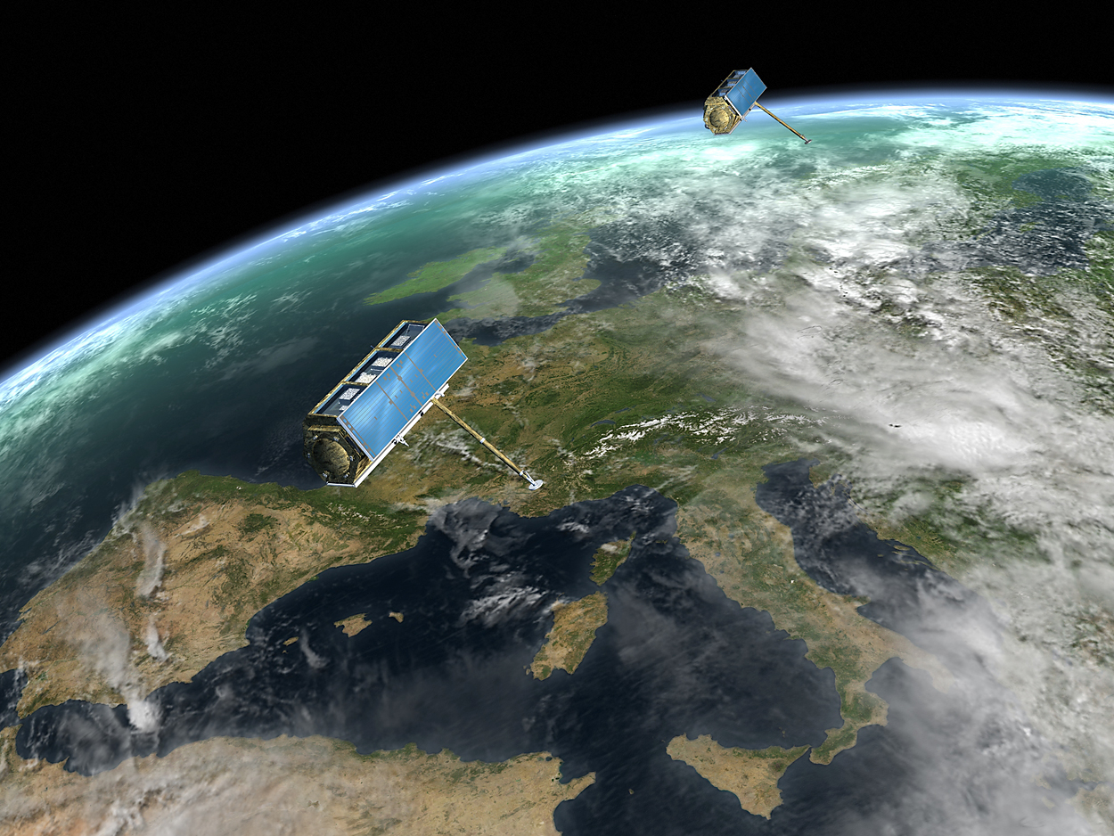
TerraSAR-X flies over Europe
The continuing fall of space launch costs and increasing diversity of launch options will undoubtedly open up new capabilities for both military and civilian customers. One of particular military interest is what is usually referred to as "responsive space launch", the ability to put a satellite in a specific orbit on short notice, probably for increased coverage of a crisis area.10 So far, this is mostly hypothetical, with a demonstration carried out in 2023 using a Firefly Alpha booster, but no follow-on so far. It's entirely plausible that the new age of "proliferated constellations" with hundreds or thousands of units will ensure full coverage everywhere and provide better resistance to ASAT weapons.
This brings to a close my series on military spaceflight, where I have attempted to cover everything from how orbits work to communications and space surveillance. Space capabilities are already vital, and will undoubtedly grow even more so in future years, particularly as space forces gain greater independence and push for increased roles and budgets. We're already starting to see this, and we should be on guard to make sure that space, vital though it is, stays in its proper place.
1 This is a composite of Landsat 8/9 data with Band 5 mapped to red, Band 4 to blue and Band 3 to green. This is the most common false-color composite you see with Landsat data. My work from USGS data. ⇑
2 In case it isn't obvious, remote sensing is one of my niche interests, and I am absolutely the kind of person who has looked at his city in various spectral bands. If you're interested in learning more, the old NASA remote sensing tutorial is probably the best overview I know of. ⇑
3 It's also worth noting that the terrain relief is much higher in this image. Any guesses as to why? ⇑
4 The ultimate development of this technique is hyperspectral imaging, which as the name suggests attempts to pull basically a full spectrum for every pixel in the scene, producing 200+ bands while standard multispectral sensors top out at around 20. So far, this technique appears to be almost entirely limited to aerial sensors, probably because it simply takes too long to get a decent resolution. ⇑
5 Two notes here. First, one of the standard Digital Elevation Models (DEMs) comes from the Shuttle Radar Topography Mission, the only case I am aware of where a manned space remote sensing platform produced a significant amount of data. Second, the standard method of creating topographic maps was through the use of pairs of aerial photos, and a similar technique was used for the current standard in DEMs. ⇑
6 Composite of Bands 7, 6 and 4 mapped to RGB, picked via the very scientific process of trying things until it looked good. ⇑
7 Amusingly, SPOT would later serve as the basis for France's first dedicated recon satellites. ⇑
8 Panchromatic (black-and-white) imaging is easier to get a high resolution on because you have more light to work with, but color obviously provides a lot of benefits, and carrying both sensors allows some fancy combining tricks to be done. ⇑
9 Then there's really weird cases like Spire Global, which operates a "Space-as-a-service" platform using CubeSats (small, standardized satellite busses). Services include AIS for tracking ships, ADS-B for tracking planes and private weather satellites, for those who need more data than you can get from government sources. ⇑
10 Note that this is only going to work for LEO satellites, and it's probably not the most effective counter to ASAT weapons. ⇑
Comments
Sun is at a lower angle?
But isn't the satellite in a sun-synchronous orbit designed to minimize changes in sun angle?
Reduced change isn't zero change: 10am in January isn't the same sun angle as 10am (or any time, given that shadows depend on azimuth not just elevation) in May.
Yes, that's it. There's a reason I framed my first response as a question, although I am still a bit surprised at how stark the difference is.
Let's do the math:
Edward's is at 34°52' N.
Assuming the photos are taken at noon of each solstice...
The sun is at:
34°52' - 23°27' = 11°25' (summer)
34°52' + 23°27' = 58°19' (winter)
south of overhead.
Being a month off the solstice will narrow the spread by a degree or two each side.
Also, the Landsat orbit crosses the equator at 10 AM. But the ~40 deg swing is still a big deal.