
Both recon satellites and communications satellites provide useful capabilities on their own, but when combined with a third type of satellite, they are truly revolutionary. The last 25 years have seen warfare changed by the advent of cheap smart weapons that can be guided to positions supplied by platforms far away from the shooter, a capability that fundamentally rests on satellite navigation. More than that, satellite navigation has become a vital public utility, the greatest direct service the military provides the civilian world.
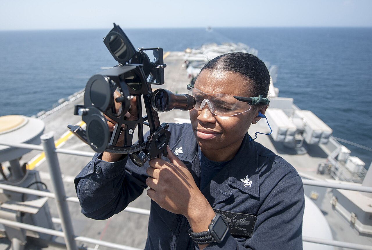
A sailor shoots the sun aboard USS America
The use of space for navigation goes back thousands of years, thanks to the use of stars as fixed points. The Polynesians were the first to use this for oceanic voyages of astonishing scale, while improved techniques were vital to European exploration in the Age of Discovery. Latitude is easy enough to find from the height of Polaris above the horizon, or the height of the Sun at noon. Longitude is more difficult, lacking as it does a straightforward physical reference, and has to be determined by the difference in time between a known location and the location of the navigator. This can be done by precisely calculating the time of an event in the sky, such as the Moon eclipsing a specific star, but this is difficult to observe, particularly on a ship at sea. A better solution came in the form of the chronometer, a clock designed to keep regular time despite the motion of the ship. These methods were standard up until the 1940s, and are still taught today as backups in case everything else fails.
The first generation of electronic navigation aids such as LORAN obviously relied on terrestrial systems, and the genesis of satellite navigation comes from a technique developed to track Sputnik I. A pair of scientists, listening to the signal, realized that they could figure out a satellite's orbit by listening to the doppler shift of a radio signal it produced. The details involve a lot of complicated math, but it didn't take long for someone to realize that the same logic could be used in reverse. Instead of measuring the doppler shift from a known location to work out an unknown orbit, doppler from a known orbit could be measured from an unknown location to work out where the observer was. The Navy immediately saw the potential of this and began work on a system known as Transit, largely in support of the Polaris program.
An early Transit receiver
The basics of the system were simple. All 2D fixes require two pieces of data, and both could be worked out from a single satellite pass, using the satellite's groundtrack as a reference. Position along the track was easy, as the doppler was zero at the point of closest approach. Distance from the track was harder, but the shift was greatest directly under the track, and dropped off as the receiver moved away. And in the early 60s, computers were just powerful enough to work all of this out in a reasonable amount of time. The UKY-1 computer that went aboard the first Polaris boats took about 15 minutes to work out a solution from a 2-minute Transit pass, first guessing a location and then performing repeated refinements based on the errors it found to get a location accurate to within about 20 meters. Keeping the system accurate required a network of ground stations to monitor satellite orbits and update the orbital elements (which were broadcast by the satellites as they went overhead). This procedure also helped map out Earth's gravity field, which in turn helped make ballistic missiles more accurate.
Transit 2A is prepared for launch, with GRAB-1 atop it
The first Transit satellite was orbited in 1960, and the second, later that year, carried GRAB-1 along with it. The system was declared operational in 1964, and was composed of 10 satellites (5 primary and 5 spare) in 600-mile polar orbits, giving a fix every few hours at the equator, and more frequently near the poles. Civilians were also allowed to make use of the system, although they were only given access to a low-precision set of elements, which limited single-pass accuracy to about 100 m. However, a fixed receiver could average multiple passes for astonishingly precise location, often to under a meter, a useful capability for surveying and geodesy. To work, the system also had to provide a very accurate time signal to anyone listening, a useful and underappreciated capability.
It was this time signal that would form the core of Transit's replacement, something that could provide a position almost instantly anywhere on the globe, and which would take satellite navigation from a niche tool of mariners and surveyors into the pockets of most of the human race. Even as Transit was becoming operational, both the Air Force and the Navy began investigating systems that could be used by airplanes (which moved too quickly for an accurate Transit fix) and didn't have to wait for a pass.
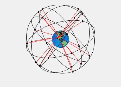
GPS satellites visible from a specific point
The solution they picked was based upon the fact that light travels at a constant speed, which meant it could be used to find the range from a satellite to the receiver. Each satellite would carry a set of very precise atomic clocks, and a receiver that could see four satellites could work out where it was.1 Ultimately, the plan for what was dubbed the Global Positioning System was for 24 satellites in 12-hour (20,200 km) orbits, split into six planes inclined at 55°, a design that would guarantee six satellites should be visible at any point on Earth's surface. In practice, a few extra satellites are usually on orbit as spares and are used to give even better accuracy.
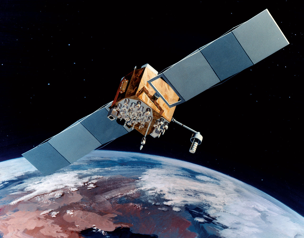
The first GPS test satellite was launched in 1978, and prototypes continued to fly through the mid-80s. The first operational (Block II) satellite flew in 1989,2 and by the fall of 1990, enough were on orbit to give the Coalition forces facing down Saddam a major navigational advantage. For the first time, a staff officer could draw a line on the map in a trackless desert and expect the forces in the field to be able to find it, despite the lack of sufficient satellites to give round-the-clock coverage. The fact that GPS inherently provides an accurate time to any receiver also removed the risk of time coordination going wrong due to a poorly set watch. This capability was so critical that thousands of civilian GPS units were rushed to the troops in Saudi Arabia, and there are even reports that the Iraqis used GPS receivers to help target SCUDs. Nor were the benefits limited to ground forces, as the low cost of GPS receivers made it a natural choice for weapon guidance without the headaches of TERCOM. The Air Force employed GPS-guided CALCMs during the opening of the Desert Storm air campaign, and the 90s saw the same technology deployed on Tomahawk and then in the truly revolutionary JDAM.
GPS goes to war
Nor were the benefits limited to the military. Initial plans had been to restrict it to official users only, but in the wake of the Soviet shootdown of a Korean airliner that had wandered off course, Reagan announced plans to broadcast an unencrypted signal for civilian use alongside the encrypted military signal. Initially, this was intentionally degraded, limiting accuracy to around 100 m (military standards at the time were around 5 m), but "Selective Availability" was turned off in 2000, with the military claiming it had the ability to limit GPS in a specific area in a time of crisis, presumably by using electronic beamforming to null out the signal in a specific region. In 2007, it was announced that future satellites wouldn't even be capable of Selective Availability, but this seems a matter of what software is loaded, and could presumably be reversed relatively quickly.

A pocket watch, set by satellite
Of course, the civilian use of GPS needs little elaboration, and satellite navigation has become a bona fide public utility, with the paper map rapidly fading into near obsolescence. A typical smartphone is often able to do considerably better than 5 m accuracy even without the benefit of other positioning technologies, while those who need extreme accuracy can use various augmentation technologies, which take advantage of the fact that the errors in GPS tend to be pretty consistent over a wide area, allowing a fixed ground station to measure them and transmit a correction signal to nearby receivers. Differential GPS offers accuracy of 1-3 cm, a vital tool in the arsenal of the modern surveyor, while aircraft take advantage of satellite broadcasts like the Wide Area Augmentation System to allow them to make precision approaches even in zero visibility. Other countries were quick to see the advantages of GPS, and the potential problems of leaving the US government with a monopoly on the technology. The EU, Russia and China each have their own global navigation constellation, while Japan and India operate regional systems.
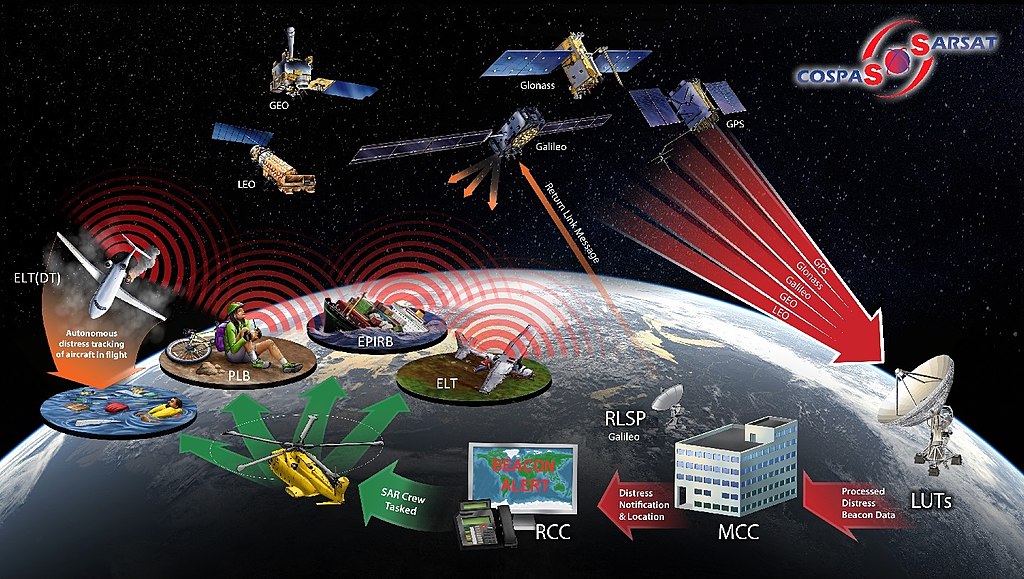
Weirdly, these satellites still carry an echo of the Transit technology, even though Transit itself was axed in 1996. To help locate people in distress in remote areas, the International Cospas-Sarsat Programme has locators for distress beacons using the standard 406 MHz signal on a number of navigation satellites. While some beacons have GPS capability and send their location directly to the satellite, it can also locate a beacon without said capability by looking at the doppler shift of the transmitted signal, much as Transit did to figure out where it was. This network, which works with local SAR teams, is credited with saving over 3,000 people every year.
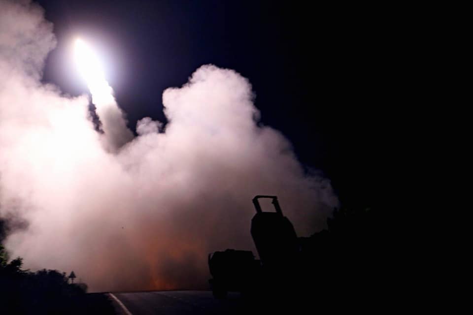
Ukrainian forces fire a HIMARS
With increasing dependence on GPS for a variety of uses comes increasing concern about the possibility of the network being disrupted. While the satellites themselves orbit high enough to be mostly immune to current ASAT systems and have been designed to work for months without the aid of ground stations, there is still the threat of the enemy jamming the signal. This has proven to be a serious problem in Ukraine, with the initial success of the GPS-guided HIMARS falling off as the Russians have deployed jammers fairly widely. To counter this, the US military is putting increased emphasis on operations in GPS-denied environments, largely through the use of inertial navigation systems, and GPS satellites launched since 2018 have a spot beam capable of transmitting 100 times more signal to a specific area, greatly reducing the effectiveness of jammers.
Space capabilities have revolutionized warfare over the last 70 years, but there is an obvious caveat. Satellites can only benefit forces on the ground so long as they remain intact and operational, which brings us to the subject of space warfare, a field that ranges from the fairly mundane aspects like tracking various satellites all the way to physically shooting them down. We'll start taking a look at that next time.
1 Four satellites are required because the receiver doesn't have a very good clock of its own, and thus can't figure out an unambiguous range from each satellite. In essence, it has to solve for a problem in 4 dimensions, three of space and one of time, requiring four pieces of data. ⇑
2 It is worth noting that these satellites also carried the nuclear detonation detection system previous carried by DSP and Vela. ⇑
Comments
GPS is amazing; I realize that people are training to use the old methods in case GPS goes down, but I wonder just how serious they are about doing that training, and whether or not it would actually work if they actually had to do it.
@Tony
The old methods work, for certain values of work. Like, you can still navigate to a port or through a straight with a sextant and chronometer, which is important if you want to keep your carrier off the rocks. But you're not going to have celestially navigated cruise missiles. (Yes, ballistic missiles have celestial navigation / star sights, no that's not going to work for a Tomahawk)
I do wonder if they have a backup version of 'tactical terrestrial radio navigation', using either DME/LORAN/distance from transmitter; terrestrial/airborne GPS psuedo-satellites; or VOR/bearing from transmitter, as an alternate method of intermediate navigation to compliment inertial navigation systems, especially for land warfare units that can't support the same kind of inertial systems that you might have on a sub or bomber. It doesn't sound like it from the publicly available information I've seen, but then it's not exactly the kind of thing you would want everyone to know about, especially if it can be integrated with existing GPS systems relatively seamlessly.
At least in the civil aviation world, nobody is allowed to file an IFR flight plan that they can't complete with some non-GPS navigation system. So we all keep both our skills and our equipment up to date for that. Fortunately, the old-style radio navigation beacons (VOR and DME) are still maintained. For transoceanic flights, I believe airliners still have inertial navigation systems that are good enough for the relatively short flight times.
Not sure what the current state of affairs is in the maritime world. Unlike aviation, their LORAN radio beacons have I believe all been decomissioned, and inertial navigation isn't good enough over a period of weeks, so they would have to fall back on sextants, chronometers, and tricky math.
John Schilling:
Which a computer can do for them.
The obvious difference between the two is what happens when things go wrong. Any plane that takes off has a very finite clock before it has to come down. Whereas I suspect that the standard procedure for a navigation failure at sea is to keep an eye on the fathometer and radio for help.
@Anon
Yes, if they have a computer programmed to do it, and know how to get the data for it. The second half of that is the bigger problem. There's been work on automated celestial nav systems recently, but I don't think any are in wide production, certainly not at price points where they can easily go on merchant ships.
@bean
I don’t think making a computer that is accurate as a semi-trained mariner is such a difficult problem. Star trackers, are, after all, available by the dozen.
But a bronze sextant is probably much easier to get reliable in edge cases than a camera.